


Description
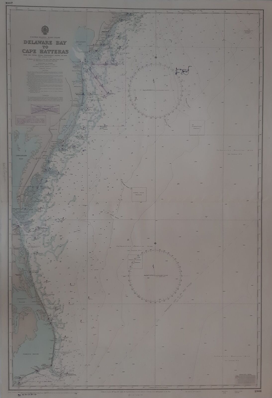
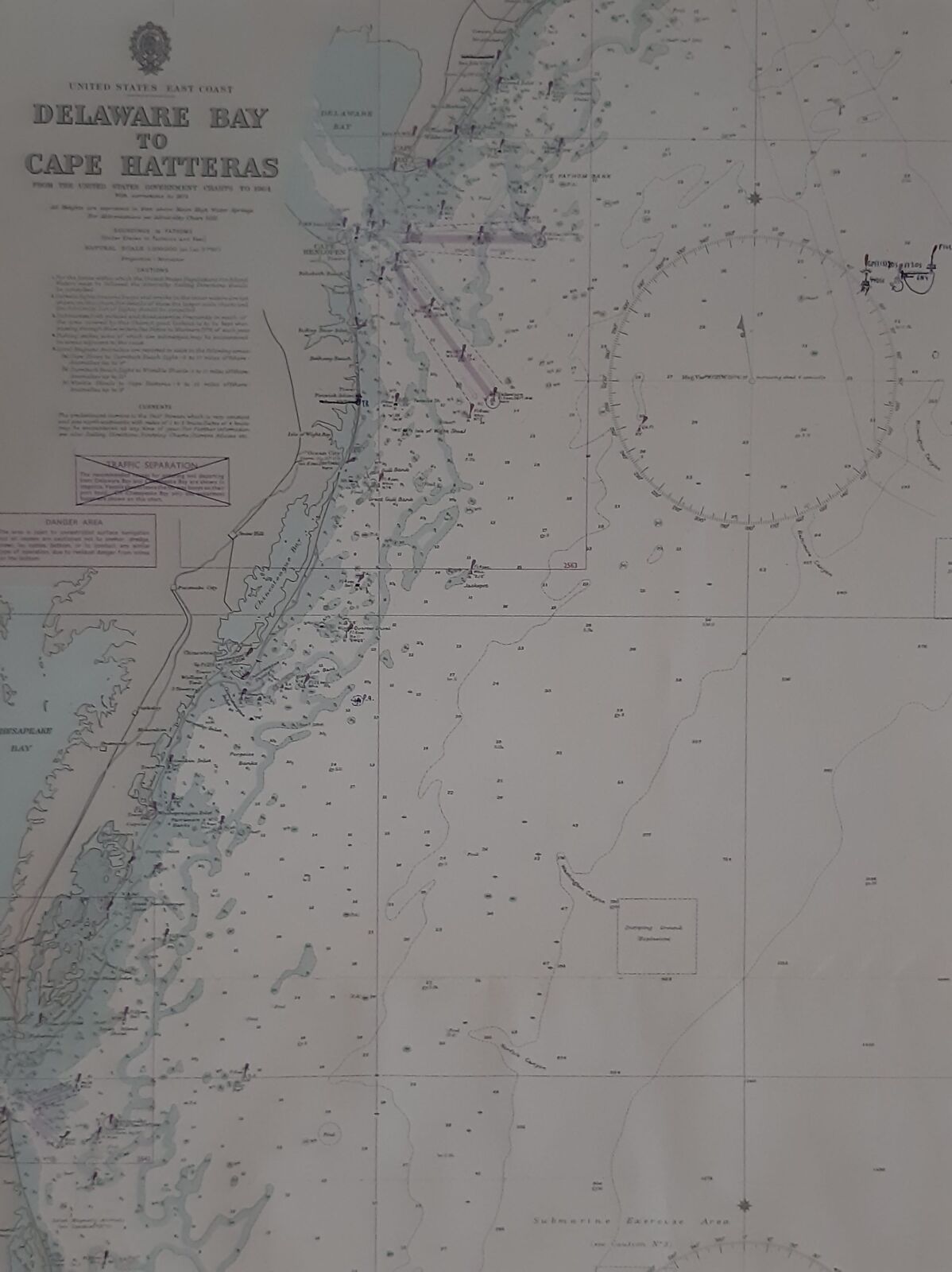
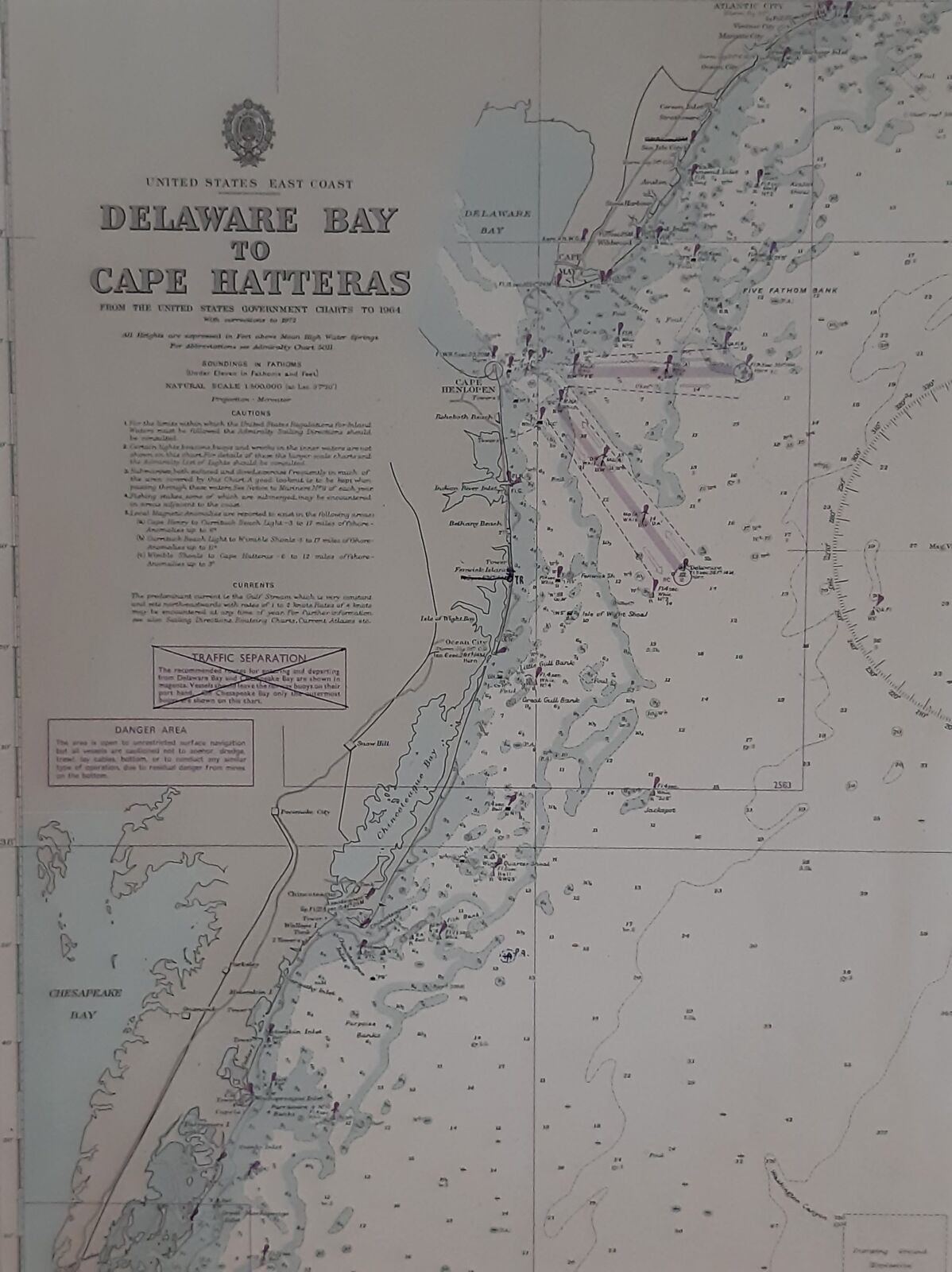
Full title: United States. East Coast. Delaware Bay to Cape Hatteras. No. 2861
Maps and charts Notes From the United States Government Charts to 1964. With corrections to 1972. Natural Scale 1: 500.000. All Heighs are expressed in Feet above Mean high Water Springs.Soundings in feet.


